Kanchenjunga trek: what agents need to know before selling it
The Kanchenjunga trek is a long, remote trek in far eastern Nepal to the north base camp at Pangpema (5,143 m), the south base camp at Oktang, or both. It needs a restricted area permit (USD 20 per person per week for the first four weeks) and the Kanchenjunga Conservation Area permit, booked through a registered agency with a licensed guide. Our itineraries run 16 to 20 days, and the access by road or flight is the part that needs the most buffer.
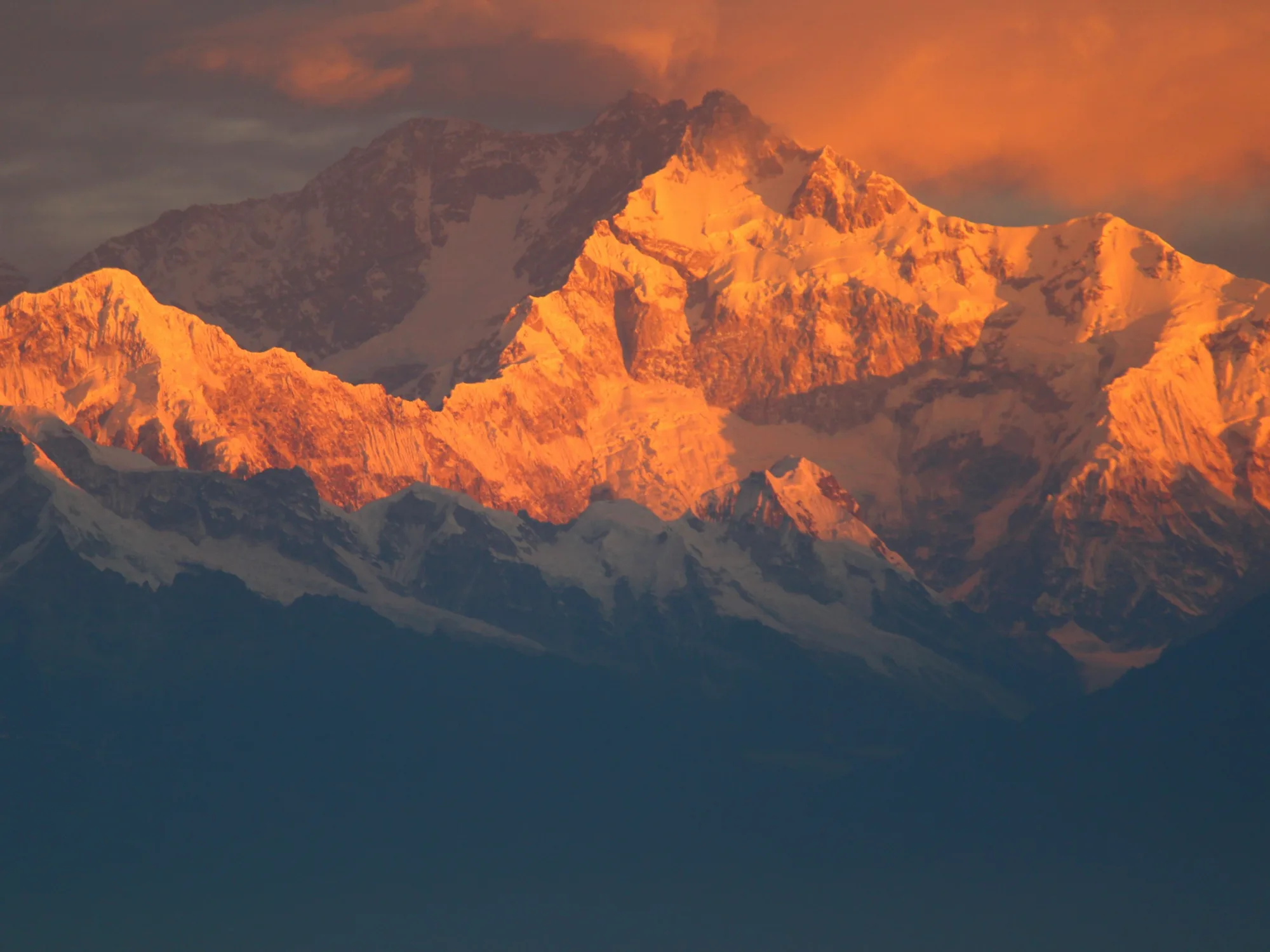
| Kanchenjunga summit | 8,586 m, the second highest mountain in Nepal and third highest in the worldSource: DNPWC, Kanchenjunga Conservation Area |
|---|---|
| Restricted area permit (Taplejung) | USD 20 per person per week for the first four weeks, then USD 25 per person per weekSource: Nepal Tourism Board, Trekking Permit (checked 22 Nov 2026) |
| Kanchenjunga Conservation Area entry | NPR 2,000 per foreigner per entrySource: Nepal Tourism Board, Kanchenjunga Conservation Area (checked 22 Nov 2026) |
| Solo trekkers | Allowed in restricted areas since March 2026, through a registered agency with a licensed guide; maximum seven trekkers per guideSource: The Himalayan Times, 23 Mar 2026 |
| Conservation area size | 2,035 sq km, designated a conservation area in 1998Source: DNPWC, Kanchenjunga Conservation Area |
| Suketar (Taplejung) airport | Elevation 2,419 m, runway 700 m by 20 m, listed in operationSource: CAAN e-AIP, AD 2 aerodrome list, effective 30 Apr 2026 |
| Best seasons | March to May and September to NovemberSource: Nepal Tourism Board, Kanchenjunga Conservation Area |
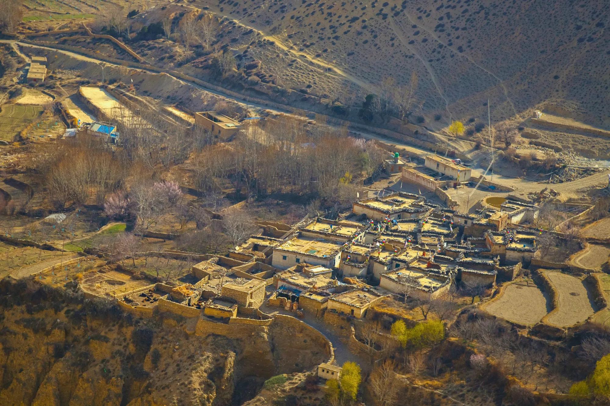
The Kanchenjunga trek is the far eastern counterpart to Everest and Annapurna: a long walk through Limbu and Sherpa villages to the foot of the world's third highest mountain, with far fewer trekkers on the trail. It is also one of the harder Nepal treks to deliver well. Clients need a restricted area permit, a registered agency and a licensed guide; the access by road or small aircraft is slow and weather dependent; and the upper valleys have only a handful of simple lodges. This briefing is for agents and tour operators who want to sell Kanchenjunga with the right expectations, the right buffers and the right clients. It reflects what we checked on 22 November 2026.
Kanchenjunga in brief
Kanchenjunga stands at 8,586 m on the border between Nepal and the Indian state of Sikkim. The Department of National Parks and Wildlife Conservation (DNPWC) describes it as the second highest mountain in Nepal and the third highest in the world. The Nepal side is protected by the Kanchenjunga Conservation Area, which covers 2,035 sq km of Taplejung district and was designated a conservation area in 1998. Management was handed to the Kanchenjunga Conservation Area Management Council in 2006, according to a DNPWC publication on the area.
There are two classic objectives, and agents should be clear which one they are selling:
- North base camp (Pangpema): up the Tamor and Ghunsa valleys through Ghunsa and Lhonak to Pangpema below the north face. The Kathmandu Post gives Pangpema as 5,143 m, which matches our own itinerary high point.
- South base camp (Oktang): the southern approach via Yamphudin and Tseram to the Yalung glacier, with views of Jannu and the south face. Our south side itinerary tops out at 4,730 m.
- Both sides: the two approaches can be linked over the Sele La and the passes between Ghunsa and Tseram. The Kathmandu Post describes the Sele La crossing as over 4,200 m. This is the most complete trip and the most demanding.
Before you build a programme, read our restricted area permits explainer, which sets out how these permits work across Nepal, and our trekking programmes for the full itineraries.
Who the Kanchenjunga trek suits, and who it does not
Kanchenjunga is a trip for experienced trekkers who have already walked in the Himalaya and want something quieter and more remote. It rewards clients who value landscape, culture and solitude over comfort and convenience.
- Good fit: repeat Nepal clients who have done Everest or Annapurna, small private groups and clubs with a flexible return date, photographers, and fit walkers comfortable with long days of climbing and descending in forest and on moraine.
- Possible with care: strong first time Himalayan trekkers with plenty of hill experience at home, on the south side itinerary, which is shorter and lower.
- Poor fit: clients with fixed, tight international flights, anyone who needs hot showers and private bathrooms every night, clients who struggle on steep, rough trails, and groups who want the social buzz of the Everest trail.
Be clear about the walking. The early days follow river valleys with long climbs and descents, and the upper days cross glacial moraine at altitude. The trek is long because the terrain is long, not because of rest days, so fitness matters from day one.
Best months for Kanchenjunga
The Nepal Tourism Board gives March to May and September to November as the best seasons for the Kanchenjunga Conservation Area. In practice we sell two windows:
| Season | What to expect | Our view |
|---|---|---|
| Spring (March to May) | Rhododendron forest in flower on the lower trail, warmer days, more afternoon cloud, snow lingering on the passes early in the season | Good, especially April and May |
| Monsoon (June to August) | The monsoon enters Nepal from the east; the Himalayan Times gives the average onset over eastern Nepal as 13 June. Leeches, cloud, landslides on roads and trails | We do not recommend it |
| Autumn (September to November) | Clearer views once the monsoon ends, colder nights at altitude by November, a risk of late monsoon damage to roads early in the season | Best overall, from early October |
| Winter (December to February) | Cold, snow on the high camps and passes, some lodges closed | Not for standard groups |
Autumn weather is not guaranteed. In late October 2026 the Department of Tourism advised trekkers and climbers to stay out of high areas for several days because of a heavy snow and avalanche forecast, and restricted area permits were briefly paused. Our Nepal weather by month guide covers the regional pattern in more detail.
Kanchenjunga permits and the rules that apply
Kanchenjunga needs two permits: the restricted area permit for the upper wards of Taplejung, issued by the Department of Immigration, and the Kanchenjunga Conservation Area entry permit. Our Nepal trekking permits guide covers national park and conservation area permits across the country. The table below covers Kanchenjunga only.
| Item | Current rule or fee | Source | Checked |
|---|---|---|---|
| Restricted area permit, Taplejung (Phaktanglung wards 6 and 7, Mikwakhola ward 5, Sirijunga ward 8) | USD 20 per person per week for the first four weeks, then USD 25 per person per week | Department of Tourism and Nepal Tourism Board permit tables, which agree | 22 Nov 2026 |
| Kanchenjunga Conservation Area entry | NPR 2,000 per foreigner per entry; the SAARC rate differs between official pages, so confirm it with us | Nepal Tourism Board, Kanchenjunga Conservation Area page | 22 Nov 2026 |
| Agency and guide | Apply through a registered trekking agency and travel with a licensed trekking guide; the agency is responsible for emergency rescue | The Himalayan Times, 23 Mar 2026 | 22 Nov 2026 |
| Solo trekkers | Allowed since March 2026; before that a group of at least two was needed | The Kathmandu Post, 22 Mar 2026 | 22 Nov 2026 |
| Guide ratio | Maximum seven trekkers per guide | The Himalayan Times, 23 Mar 2026 | 22 Nov 2026 |
Three practical points follow. First, the weekly basis means a 16 to 20 day trip falls within the first four weeks, so the restricted area fee is modest compared with Upper Mustang or Upper Dolpo. Second, the permit names the area and the dates, and walking outside them is an offence, so route changes after issue are not a formality. Third, the guide requirement applies for the whole time in the restricted wards, and our mandatory trekking guide rule explainer covers how it fits with the wider guide rule in conservation areas.
On TIMS cards, the Trekking Agencies' Association of Nepal lists visitors to controlled areas with Department of Immigration permits as exempt, but a 2023 Himalayan Times report listed the Kanchenjunga region among the 14 regions needing TIMS and a guide. We confirm at the time of booking whether a card is being asked for; our TIMS card explainer on the Insights page has the background.
Access via Bhadrapur or Suketar
Getting to the trailhead is the weak point of every Kanchenjunga programme. There are two ways in from Kathmandu.
Fly to Bhadrapur, then drive
Bhadrapur in Jhapa, on the plains of eastern Nepal, has frequent flights from Kathmandu. Buddha Air lists five daily flights of about 45 to 50 minutes and Shree Airlines lists two. From Bhadrapur the road climbs through Birtamod, Ilam and Phidim to Taplejung, the district headquarters. The Kathmandu Post puts the road journey between Taplejung and Bhadrapur at 8 to 9 hours. From Taplejung, jeeps continue up the valley on rough tracks; on the north route the Kathmandu Post notes that the road ends after Sekhathum and the trek begins.
Fly to Suketar
Suketar airport near Taplejung sits at 2,419 m with a 700 m runway, and the Civil Aviation Authority of Nepal lists it as in operation. Scheduled service, however, has been patchy. The Kathmandu Post reported in March 2025 that there had been no flights since 9 December 2024 after Nepal Airlines' Twin Otter service stopped, and that other airlines had flown the route only in the tourist season. We check the current schedule in the week of travel and treat a Suketar flight as a bonus when it is running, not as the plan. Our domestic flights guide explains how we handle mountain sectors more generally.
Road risk
The road from the plains crosses hill country that is hit hard by monsoon rain. In October 2025 the Kathmandu Post reported more than 80 landslides between Ilam and Panchthar after continuous rain on 3 and 4 October, and the Mechi Highway section in Panchthar reopened only after 14 days. That is why we avoid early autumn departures that leave no slack on the access days.
Operator tip: plan Kanchenjunga as a road trip with an optional Suketar flight, not a flight trip with a road backup. Put one contingency day before the drive out, and keep at least one clear day in Kathmandu before the international departure. For spring groups, a night in Ilam or near the airport on the way in breaks the drive and lets clients arrive at the trailhead rested.
Logistics and risks on the trail
Lodges or camping
The Nepal Tourism Board lists both tea houses and camping for the conservation area. Lodges have grown in recent years: the Himalayan Times, citing the conservation area council, reported 52 hotels on the base camp routes in 2022, and in 2024 reported that some closed hotels were reopening as numbers rose. They are small and basic, and on the upper route they are few, so capacity is limited for a group in peak weeks. Our Kanchenjunga itineraries are camping-supported, which gives the group its own kitchen and sleeping arrangements where lodges are full or too basic. If clients prefer more lodge nights, tell us early and we will plan around the villages that can take a group.
Visitor numbers
Numbers are small. The Himalayan Times reported more than 300 foreign tourists in the autumn 2025 season, according to the Ghunsa check post. That is the appeal, and it also means fewer people on the trail to help in an emergency.
Altitude and terrain
The north side spends several nights above 4,000 m before Pangpema, and the crossing between the two sides involves high, exposed ground. Build gradual sleeping altitude gains and an acclimatisation day at Ghunsa or Khambachen; our altitude sickness and itinerary design guide sets out the principles we use. Landslides are a real hazard on the lower trail: the Himalayan Times reported that a landslide near Ilifok, close to Japantar, killed a tourist assistant in October 2024.
Rescue and insurance
Helicopter evacuation is possible but slower than in the Everest region because of distance and weather. Clients need policies that cover trekking to the itinerary altitude and helicopter evacuation. Our trekking insurance guide lists the cover we ask for, and we brief every group on how an evacuation is authorised before they leave Kathmandu.
North, south or both: comparing the options
| Factor | North base camp (Pangpema) | South base camp (Oktang) | Both sides |
|---|---|---|---|
| Duration (our itineraries) | 18 to 20 days | 16 to 18 days | Longer; ask us for a combined plan |
| High point | 5,143 m | 4,730 m | 5,143 m |
| Main scenery | North face, Kanchenjunga glacier, high moraine | Yalung glacier, south face, Jannu | Both faces of the massif |
| Culture | Sherpa and Tibetan influenced villages around Ghunsa | Limbu villages on the lower approach | Both |
| Best for | Strong trekkers who want a high objective | Clients short on time or altitude | Experienced trekkers with time |
| Main risk | Altitude and weather at the top | Steep forest trail and road access | Pass crossing in poor weather |
For clients deciding between Kanchenjunga and another long trek in a restricted area, our Manaslu Circuit briefing covers a shorter, more developed alternative with easier access.
For travel agents: how to package it
Kanchenjunga sells best as a premium small group or private departure with a realistic itinerary. It is not a trip to discount or to compress.
- What to include: the restricted area permit and conservation area permit handled by us as the registered agency, a licensed guide for the whole restricted area stay, porters, camping and kitchen crew where lodges do not suit, Kathmandu to Bhadrapur flights, private road transport to the trailhead and back, and hotel nights on the way in and out.
- Buffers: at least one contingency day before the drive out, plus one clear day in Kathmandu before the international flight. In September and early October, consider two.
- Who it suits: repeat Nepal clients, trekking clubs, photographers and small private groups who want a wild, quiet trail and accept simple facilities.
- Upsells: a combined north and south itinerary, a tea garden stop in Ilam on the drive, an extra rest day at Ghunsa, or a helicopter exit priced separately on request.
- Pricing: keep government fees as a separate line in your quote so a fee change does not cut into your margin, and price contingency days in from the start.
- Insurance: require cover for trekking to the itinerary altitude and for helicopter evacuation, and explain to clients that the agency carries responsibility for rescue arrangements under the restricted area rules.
We are licensed by the Government of Nepal for trekking and are a TAAN member. We use our own guides and transport with our own hotel contracts, and we handle FIT to large groups, standard to luxury. Guides in other languages are available on request with advance notice. Our office is open Sunday to Friday, 10:00 to 17:30 Nepal time, and closed on Saturdays and Nepal public holidays.
If you want to add Kanchenjunga to your programme, talk to us about a partnership and we will send itineraries, current permit rules and net rates for your dates.
Frequently asked questions
How long is the Kanchenjunga trek?
Our itineraries take 18 to 20 days for the north base camp at Pangpema and 16 to 18 days for the south base camp at Oktang, counting from Kathmandu. Combining both sides adds several days, and we add buffer days for the road and flights.
Is Kanchenjunga a restricted area?
Yes. The upper wards of Taplejung district are a restricted area, so clients need a restricted area permit issued through a registered trekking agency and must travel with a licensed guide. They also need the Kanchenjunga Conservation Area entry permit.
Is the Kanchenjunga trek teahouse or camping?
Both are possible. The Nepal Tourism Board lists tea houses and camping, and small lodges now operate in the main villages, but they are simple and few in number on the upper route, so our Kanchenjunga itineraries are camping-supported.
Can a solo traveller do the Kanchenjunga trek?
Yes. Since March 2026 the Department of Immigration issues restricted area permits to single trekkers, but the trekker must book through a registered agency and walk with a licensed guide.
How do clients get to the start of the trek?
Most groups fly from Kathmandu to Bhadrapur and then drive to Taplejung, which takes most of a day. Flights to Suketar airport near Taplejung exist but have been suspended for long periods, so we do not plan a trip around them.
Sources
- Department of Tourism, Trekking routes and restricted area fees
- Nepal Tourism Board, Trekking Permit
- Nepal Tourism Board, Kanchenjunga Conservation Area
- DNPWC, Kanchenjunga Conservation Area
- The Himalayan Times, Solo trekkers allowed in restricted areas with new permit rules (23 Mar 2026)
- The Kathmandu Post, Closure of Suketar airport worsens travel difficulties for Taplejung locals (3 Mar 2025)
- The Kathmandu Post, East Nepal settlements cut off as landslides bury key roads (6 Oct 2025)
- The Kathmandu Post, Kanchenjunga Circuit: An unspoiled escape (10 May 2025)